
Casa Rural PEPITA DE LAS FLORES
en Tejeda (Capital Municipal) CR-35/1/0021 ![]()
 Imprimir
 Propietarios

|

|

 Datos generales.
 Descripción
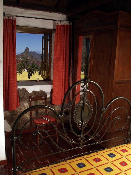
Casa campesina tradicional Canaria, rehabilitada, con más de 200 años de antigüedad, de piedra con suelo de madera manteniendo la estructura y los materiales originales de su construcción. Su mobiliario se ha conservado y se ha rehabilitado sin desechar el disfrute y el confort de los avances de la actualidad, incorporando electrodomésticos y otros elementos que hagan confortable la estancia.
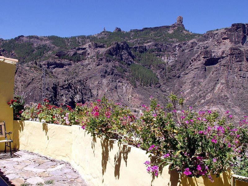
En sus dos patios se puede disfrutar de noches estrelladas a la vez de espacio amplio para la realización de barbacoas, disfrutar del sol o jugar los niños.
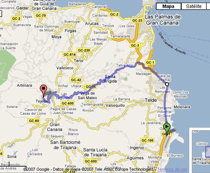
Existen una gran facilidad de conocer toda la isla, partiendo de la zona, desde la casa pepita, parten carreteras y caminos hacia todas las direcciones de la Isla, en definitiva el mismo centro de Gran Canaria. En definitiva la casa rural Pepita la de las flores, primera casa rural en todo el municipio de Tejeda es muy conocida por los ancianos del lugar ya que fue la primera tienda de la zona, después de que Juan, el marido de Pepita, llego de Cuba con algún dinero y pudieron emprender este pequeño negocio.
Situación
Dirección: Diseminado de Los Manantiales, s/n. Tejeda (Capital Municipal)
GPS: ( googlemap )
Latitud: 27° 58' 53.2700'' N
Longitud: 15° 35' 52.2500'' W
Altitud: 1300 m.
GPS: ( googlemap )
Latitud: 27° 58' 53.2700'' N
Longitud: 15° 35' 52.2500'' W
Altitud: 1300 m.
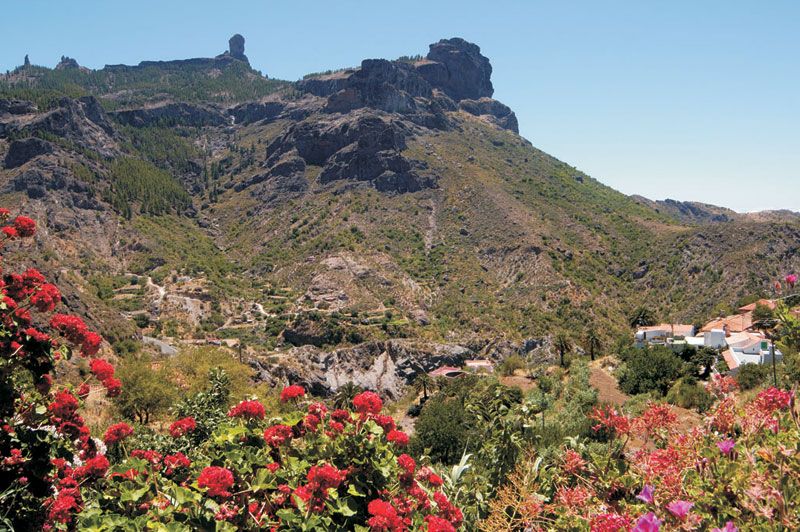
Ubicada en el "parque rural del Nublo", en el mismo centro de la isla y muy cerca del símbolo por excelencia de la Isla, "el Roque Nublo"; entre montañas con una gran posibilidad de realizar senderismo, escalada, etc. Los grandes atractivos de esta casa no se dan exclusivamente por la casa en si, sino también, por su increíble entorno, donde la ausencia de ruidos, el aire limpio, la gran cantidad de senderos, la flora y fauna, la pureza de su agua y sobre todo, la esbeltez de sus paisajes, aportan al alojamiento una riqueza incalculable. La ubicación del alojamiento "los manantiales", se encuentra apartada de la pequeña población del municipio, pudiéndose disfrutar de tranquilidad y a la vez, a poca distancia, se puede acceder a diferentes servicios de todo tipo, desde cajero automático hasta museo, supermercado o centros de interpretación de la naturaleza entre otros.
 Aeropuerto 40km (00 ')
 Centro de salud 2km (00 ')
 Comercio 2km (00 ')
 Playa 44km (00 ')
 Puerto 45km (00 ')
 Restaurante 2km (00 ')
Distribución

Dormitorios 2
Dormitorios con cama doble 1
Dormitorios con 2 camas individuales 1
NumeroCamasAuxuliares 1
Superficie de la terraza 30 m2
Superficie de la finca 300 m2
Equipamiento : Cuna , Barbacoa , Cafetera , Calefacción , Cocina , Lavadora , Televisión , Horno , Microondas , Equipo de Música , Tostadora Y Fácil aparcamiento
Casa de dos dormitorios dobles, cocina-salón-comedor, baño, terraza. patio, Cama auxiliar.
Aparcamiento cercano (50 metros) para estancias inferiores a 7 dias consultar precio.
Otros servicios
Punto de encuentro
Administrar